The city of Dhofar, or as it is known as (the land of frankincense), located on the Asian continent, is one of the governorates of the Sultanate of Oman, and constitutes a third of the Sultanate’s territory. Since ancient times, it has been known by several names such as the countries of Punt, Ophir, and also Saclan. It is a land that God endowed with many advantages and blessings that distinguish it from other cities and surrounding areas, giving it a prominent position in the Arabian Peninsula. Where is this city located? What is its importance?
Dhofar website
This governorate is located in the south of the Sultanate, and is connected to the Al Wusta Governorate to the east. As for the Republic of Yemen, it borders it to its southwest. We find that the Arabian Sea borders it to the southern side, and it is bordered to the northern side by the Empty Quarter desert, which is neutral to the borders of the Kingdom of Saudi Arabia. It is known as Najd Dhofar, and it represents the Dhofar desert.
According to the administrative divisions of the Sultanate of Oman, Dhofar Governorate consists of ten states: Salalah, Taqah, Rakhyut, Thumrait, Dhalkut, Mirbat, Maqshin, Shalim and the Halaniyat Islands, Al Mazyouna, and Sadah.
The importance of Dhofar since ancient times
This city has been known since ancient times as the land of incense and frankincense in the Arabian Peninsula. It was the primary source of frankincense for all ancient civilizations, including Greek, Pharaonic, and also Assyrian, Roman, and Persian. This is what gave it historical importance. It represents Oman’s great gateway to the Indian Ocean, and thus It constitutes the link and connection with the eastern African coast, in addition to being a crossing point for commercial caravans in the southern part of the Arabian Peninsula. We find that this region has been mentioned in many narrations and important hadiths.
Read also:Where is Ras Az-Zour located?Dhofar divisions
This region is divided into three local climatic zones, which are:
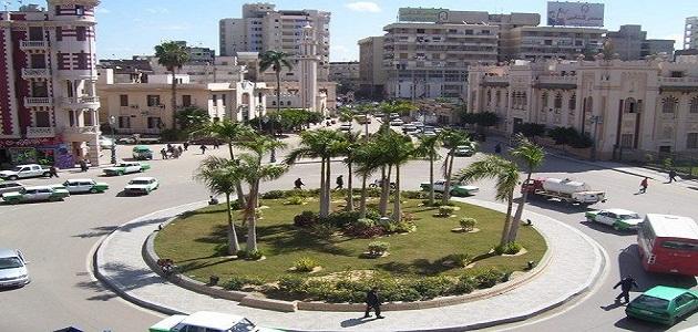
- Coastal plain: Its area is estimated at two hundred and sixty square kilometers, and it enjoys high fertility and an abundance of fresh groundwater, which is considered to be of high quality. This plain extends from the Raysut area, located in the western part of the city of Salalah, to the outskirts of the western city of Taqah. This region enjoys four seasons a year. It is characterized by moderate temperatures throughout the year.
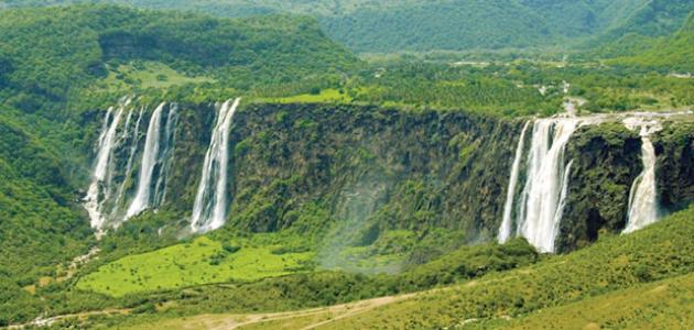
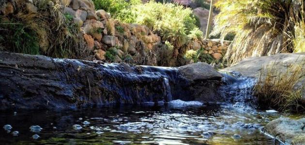
- Dhofar Mountains: It is the region that is affected by the monsoon winds, where we find a mountain range on the eastern side, forming what is known as the Jabal Samhan massif, within which the Wilayat of Mirbat and also the Wilayat of Sadah are located, and also the Jabal Al-Qara massif, within which the Wilayat of Salalah and also Taqah are located. The second massif is Jabal al-Qamar, It includes the state of Dhalkut and also the state of Rakhyut. These mountains are connected to each other, as they extend from the east of Dhofar to its west, and face the Arabian Sea. We find in Mount the Moon a juxtaposition between the sea and the mountain, the only separation between them is the Salalah plain.
- Badia: This range is known as desert, as it is dry and has little rain, and it overlaps on the northwestern side of Dhofar with the Rub al-Khali desert, and in this range there are four states; They are all: from the Wilayat of Maqshin, the Wilayat of Thumrait, and also the Wilayat of Shalim and the Halaniyat Islands, in addition to the Wilayat of Al-Mazyouna.


