
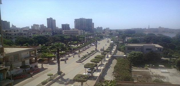

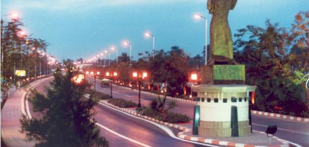
Palestine site
Palestine is located in the southwestern part of the continent of Asia, and thus connects the two continents of Asia and Africa, as well as between the Mediterranean and the Red Sea, and between the Atlantic and Indian oceans, and deserts surround Palestine from the eastern and southwestern sides. degrees and 34 minutes in the east direction, and between latitudes 15 degrees and 35 minutes and 40 degrees and 29 minutes in the north direction.
Palestine connects the civilizations of the East and the West, and the importance of its location and crossings stems from its connection between the Red and the Mediterranean Seas. Palestine was once a bridge through which people passed, especially immigrant groups, armies, and commercial convoys. It is one of the important roads that travelers pass through using various modes of transportation. Whether on land, sea, or air, Palestine is a land and sea country at the same time; As it combines the land and sea borders at a ratio of approximately 1:3; That is, it is more terrestrial than being marine.
Palestine borders
Geographical borders
Palestine, with its borders, takes the form of a rectangle; Its length extends from north to south by about 430 km, while its width from east to west increases towards the south, and expands to reach its largest width, which is 117 km, while it reaches in the central region from 70-95 km, and narrows towards the north to extend at a distance of 50-70 km. It also narrows when approaching the Aqaba region, to reach only 10 km.
Read also:Where is the Arabian Peninsula located?Palestine is classified as one of the countries with long borders in relation to its area. Its total borders are about 984 km. It is located in the west of the continent of Asia, and it is bordered to the north by Lebanon and Syria. As for the north-east, it is bordered by Syria only, and the length of the border between them reaches 70 km. As for the length of the border between it and Lebanon, it is It is bordered to the west by the Mediterranean Sea, and the Palestinian coastline is 79 km long, and the border between Palestine and Jordan is 224 km long. Palestine overlooks the northern part of the Gulf of Aqaba, and its coastline is 360 km long in the far south. Specifically, Ras Taba is located on the Gulf of Aqaba with Rafah, and the length of the border is 10.5 km.
political borders
After the end of World War I, the collapse of the Ottoman Empire, and the division of the Levant between the French and the British, Palestine acquired an international political character, and it was divided politically based on various treaties and agreements, resulting from strong conflicts in which each country seeks to achieve its interests, and among the political divisions are the following:
- The borders of Palestine stipulated in the Sykes-Picot Agreement: The Sykes-Picot Agreement stipulates that the borders of Palestine start from the south of Ras al-Naqoura, located on the Mediterranean coast, and then extend to the southeast to leave the area of the headwaters of the Jordan River and Lake Hula, to follow the French influence, and its borders are the western coast of Lake Tiberias, and move to the West Bank and the Jordan River in south to the northwest coast of the Dead Sea, then head towards Beersheba in a southwesterly direction; To end between Gaza and Rafah on the Mediterranean coast.
- The borders of Palestine stipulated in the agreement of December 23, 1920 AD: This agreement was concluded between France and England, and stipulated that the boundary separating the influence of each of them would be located on the southern shore of Lake Tiberias, extending in the middle of it and heading towards the mouth of Wadi Al-Masudiyyah. The Jordan River and its outlet, in addition to many fine details related to the borders of France and England.
- The borders of Palestine stipulated in the February 3 agreement of 1922: This agreement was signed between England and France, and divided the Palestinian borders into three borders, which is the northern border that starts from Ras al-Naqoura, passes through eastern Syria and western Lebanon, deepens to the northeast, then heads south to Hamma, and the eastern border of Palestine with Jordan, which It starts from a point 3.2 km west of the city of Aqaba, then passes through Wadi Araba, then moves to the Dead Sea and reaches its middle, then runs towards the Jordan River and from there to the Yarmouk River, and finally the southwestern border with the state of Egypt, which starts from Rafah and runs in the southern direction. east, reaching the Gulf of Aqaba.
area of Palestine
The area of the historical State of Palestine is approximately 27.000 square kilometers2; Where this area includes the lakes of Kinneret and Hula, and half of the area of the Dead Sea, while the area of the West Bank, which includes its part of the Dead Sea, is approximately 5.842 km.2The area of the Gaza Strip is 365 km2.
Read also:Where is the Arabian Peninsula located?Climate of Palestine
The climate in Palestine differs in the southern parts from that in the northern parts, and the difference is due to the astronomical location associated with longitude and latitude, so the temperature in the desert area near the Gulf of Aqaba in southern Palestine is high, reaching 25 degrees Celsius, which is thus higher than The temperature in the northern region close to Lebanon reaches 17 degrees Celsius. The climate is mild due to its influence on the Mediterranean Sea. The driest spot in Palestine is Wadi Araba near the Gulf of Aqaba. The average rainfall is about 15 mm only, and the climate is in the north. It is semi-humid, while in the south it is desert and dry, and the annual amounts of rain increase by moving from the south to the north.
The population of Palestine
The population of Palestine, according to estimates in 2016 AD, was about 4.81 million people. of whom 2.45 million are males, and 2.36 million are females, and the population of the West Bank has reached approximately 2.93 million; 1.49 of them are males, and 1.44 million are females. As for the Gaza Strip, its population is 1.88 million; Of them, 956 thousand are males, and 925 thousand are females, and the percentage of the urban population is estimated at 73.9%, while the rural population is estimated at 16.6%, while the camp population is estimated at 9.5%, according to mid-2016 estimates.
Read also:Where is Thar Desert located?About Palestine in the past
In the past, Palestine was called the land of Canaan, and it is the oldest name by which it was named, as the first people to inhabit and settle there were the Canaanites, and in the late twelfth and early eleventh centuries BC, sea peoples came from western Asia Minor, and from some Italian islands to attack the coasts of Lebanon and Palestine. And Syria and some regions of Egypt began to settle in it, but the Pharaoh of Egypt, Ramesses III, succeeded in preventing it from Egypt, and allowed those peoples to settle in southern Palestine. .
The peoples of Bliste settled in southern Palestine at the beginning, and then established five cities of their own, which are Gaza, Ashkelon, Ashdod, Ekron, and Jet. It is said: These cities were not founded by the peoples of Bliste, but rather by the Canaanites. On the plain of Marj Ibn Amer and the rest of the Palestinian coast, and they established new cities for them, which are Lod and Sicily. 750 B.C., and in the middle of the fourth century AD, specifically during the Roman-Byzantine era, Palestine was divided into First Palestine, and it includes the area from the south of Mount Carmel and Marj Ibn Amer to the center of the Dead Sea, passing through the south of Rafah, and it also includes Bisan and the northeastern end of the Dead Sea, cutting the river Jordan, and the second Palestine includes the Galilee Mountains and Marj Ibn Amer, all the way to the heights east of Lake Tiberias. The third Palestine includes the southern Rafah region and the Dead Sea, reaching the Gulf of Aqaba and the Sinai desert.
When the Muslim Arabs entered Palestine and the rest of the parts of the Levant, they divided it administratively, and used the term soldiers for each administrative unit, and Palestine became one of the soldiers of the Levant, and was divided into two soldiers: the Palestine soldiers, and it includes the first Palestine and the third Palestine, and the capital of this army is the city of Lod, then it became Ramla After it was founded by Suleiman bin Abd al-Malik, and the second army is Jordan and its capital is the city of Tiberias, and it included a section of Marj Ibn Amer and the north of the valley and the plain of Acre. As it is related to the work of urbanization, administrative affairs, and the abscess, and during the Ottoman era, Palestine was divided into several regions, but this division did not remain as it was, but was overtaken by successive rulers in ruling over it, and in the nineteenth century Palestine became two parts, namely: the Mutasarrifate of Jerusalem, and it includes half The southern part of it, while the other part is the Mutasarrifita of Nablus and Acre, and includes the northern half of the country. Present-day Palestine was divided after the First World War, and the mandate instrument and the policies of the League of Nations were applied, according to the interests of the great powers.


