

Shatt al-Arab site
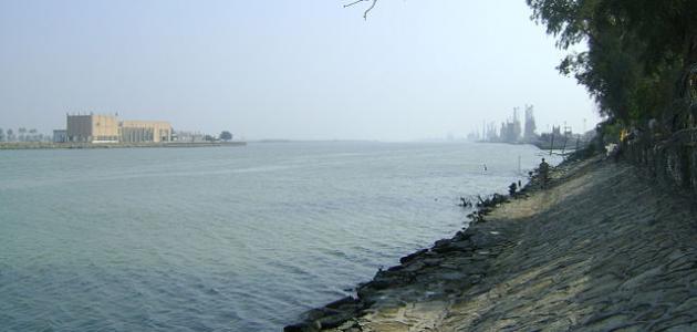
The Shatt al-Arab, also known in Iran as (Arvand Rud), is a river located in southwest Asia, extending for more than 200 kilometers, and was formed by the confluence of the Tigris and Euphrates in the village of Qurna in southern Iraq.
The Shatt al-Arab River flows into the Persian Gulf, and before that it passes through the Iraqi port of Basra, and the Iranian port of Abadan, and on its outskirts there were the largest palm forests in the world, which were irrigated naturally by tidal movements, and the Shatt al-Arab was the site of the long fighting between Iraq and Iran in the eighties .
Geography of the Shatt al-Arab
The climate in general in the Shatt al-Arab region is considered subtropical, hot, and dry, and there are vast floodplains at the northern end of the Arabian Gulf formed by the Tigris, Euphrates, and Karun rivers. It also includes swamps, forests, and huge lakes. Thanks to this wet and swampy environment, there are many species of Aquatic plants, in addition to being home to migratory water birds that stop their migration and spend the winter in it to feed on lizards, fish, frogs, and other types of animals such as water buffaloes, rodents, antelopes, deer, and many other mammals.
territorial disputes
The states of Iraq and Iran have been at odds over the control of the waterway of the Shatt al-Arab River to use it as their borders since the signing of the peace agreement in 1639 AD between the Persian and Ottoman empires. Human losses occurred during the conflicts and wars that lasted for years over the waterway, large parts of the palm forests on the sides of the Shatt al-Arab River were destroyed, and they were slowly revived later. Therefore, the Shatt al-Arab ecosystem and its health depend on the relationship between the surrounding countries, which flows through its territory.
Read also:Where is the Red Sea located?


