


Topography of the Netherlands
The country of the Netherlands (English: Netherlands) is characterized by its flat and flat land. 27% of its land is located below sea level. The lowest point in the Netherlands is located northeast of Rotterdam, about 6.7 meters below sea level. The average elevation of the entire country is about 11 meters. meters above sea level, and in general, the lowest areas are located in the north and south of the Netherlands, and in the provinces of Zeeland and Flevoland. These areas are characterized by the presence of a large area of land extending over long straight distances, which are ideal lands for the people. The Dutch go to practice their favorite activities such as cycling, and the country is generally characterized as an urban and very green country.
The Netherlands includes wild lands that contain many sand dunes and plateaus extending along the coast of Zealand all the way to the Frisian Islands. They are characterized by being covered with various herbs, but some of them are covered with pine forests. Calcareous soil is available in the Netherlands because of the sand dunes, and is suitable for the growth of fields. The famous flowers in the spring. As for the western Netherlands, there are lands that contain a lot of plant residues called peat, which helps produce fertile soil for fields and pastures that include sheep and cows. As for the delta region, it is a flat area that includes the southwestern islands, and it contains soil of... Marine clay and fertile river clay.
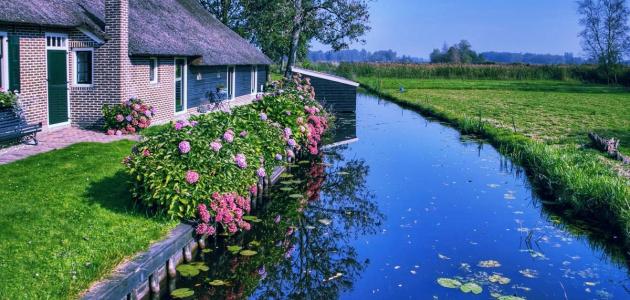
The Netherlands also includes inland islands and great rivers such as the Rhine, the Waal, and the Meuse. These rivers and their branches pass through the city center and have an important role in determining the aesthetic landscape of the country. Navigable rivers and canals extend throughout the entire country. The country extends to about 4,830 km, and there are many dams built over hundreds of kilometers that form the central water route, and they are separated from each other by field lands and pastures.
Read also:How to roast chickpeasTopography of the Netherlands
The Netherlands is divided into two main regions according to the difference in elevation and geological formations of each region, which are as follows:
Low Netherlands
The majority of the Low Netherlands regions are flat lands with low elevations below sea level, and they are more recent than the higher regions in their formation, as they were formed in the Holocene Era, which dates back to about 10 thousand years. Mainly made of peat and clay, it contains many sand dunes and dams that protect it from floods, and the low-lying areas of the Netherlands intersect with natural and artificial waterways.
Upper Holland
The High Netherlands includes land areas that are located above sea level, and its areas were formed in the Pleistocene Era, which dates back to the period extending between 2 million years and 10 thousand years. They are older in their formation than the Low Netherlands. It consists mainly of sand and gravel, and its lands are characterized by containing many hills and undulating lands, as well as farms, forests, and heath lands. In general, the western and northern regions of the Netherlands contain approximately 5 polders - which are lands Reclaimed from the sea - covering more than 2,500 km2.
Bodies of water in the Netherlands
The North Sea and surrounding coasts
The Netherlands is located on the North Sea, on the deltas of the Rhine River, the Meuse River, and the Scheldt River. The coast is divided into three types: the Netherlands coast, the Delta coast, and the Wadden Sea coast. The coast is characterized by a lot of waves, and consists of sandy beaches with multiple barriers, and sand dunes cover about 290 km of the coast. These sand dunes, along with the beach front, form a natural sand defense line from the sea side for areas located below sea level. 60 km of the coast has also been protected. By constructing buildings such as dams and barriers.
Read also:Research on the problem of water shortage and how to rationalize water consumptionInland lakes in the Netherlands
The northern and western parts of the Netherlands include many small lakes, and in the northeastern side there are more than 30 lakes linked together by canals. Here are some of the largest lakes in the Netherlands:
- Lake Isle: (in English: IJsselmeer), is considered the largest lake in the country, and is located in the southwestern side of it. It was essentially a shallow area containing salty water at the North Sea and was called the South Sea or Zuider Zee. Then a water dam called the Afslaudijk was built (in English : Afsluitdijk) in 1932 AD and its water became fresh and drinkable, and this lake now covers a large area of up to 1,210 kmXNUMX.2.
- Markermeer Lake: (Markermeer), located south of Lake IJssel, is a dammed lake containing fresh water.
- Lake Fluessen.
- Lake (Sloter).
- Sneek Lake.
Netherlands Islands
The Netherlands includes a group of West Frisian Islands (in English: West Frisian Islands), which were formed due to the penetration of the waters of the North Sea into the sand dunes that made up the old northern coast of the Netherlands, so the areas behind the sand dunes became submerged by the waters of the Wadden Sea, while the high sand dunes remained as they were, and became... After islands, the following are the largest islands spread from west to east:
Read also:How do I use pomegranate peel?- Texel Island.
- Vlieland Island, which includes the National Park in the Netherlands.
- Terschelling Island.
- Ameland Island.
- Schiermonnikoog Island.
Land reclamation system in the Netherlands
Over the course of several centuries, the Netherlands has been exposed to many floods that caused a lot of destruction to the Netherlands, claiming the lives of tens of thousands of people. Therefore, the country took many measures to protect the land from floods caused by sea water, including the following:
- Building artificial hills called polders.
- Building windmills to pump water from low-lying areas.
- Increase the level of elevation of villages and farms.
- Construction of Afsluitdijk Dam to confront sea water.
In 1953 AD, the Netherlands also implemented the Delta Project due to the exposure of the southern regions of the country to floods that led to the death of about 2,000 people. It was the establishment of a large series of sea and river dams and internal canals to protect the vulnerable lands of the Netherlands from the devastating floods resulting from the North Sea. Supporting the dams with giant pumping stations to control groundwater levels, and now the Netherlands includes a network of dams extending more than 22,000 km, noting that this network includes dams that are not designated as a means of defense against floods. The huge Delta project and other engineering projects had an important role in protecting the regions of the Netherlands from Any additional damage from North Sea floods.


