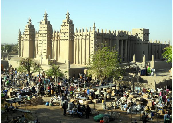
Get to know the city of Timbuktu with pictures
Timbuktu is an ancient city in Mali
It is located 20 kilometers (12 mi) north of the Niger River
The city is the capital of the Timbuktu region, one of the eight administrative regions of Mali
Its population was 54453 at the 2009 census.
Starting as a seasonal settlement, Timbuktu became a permanent settlement in the early twelfth century
After a shift in trade routes, Timbuktu prospered from the trade in salt, gold, ivory, and slaves
It became part of the Mali Empire in the early XNUMXth century
And in the first half of the XV century
The city was controlled by the Tuareg tribes for a short period until the expanded Songhai empire settled in the city in 1468.
The Moroccan army defeated the Songhai in 1591 and made Timbuktu
Instead of Gao, their capital, the invaders established a new ruling class, the Arma
Which after 1612 became independent of Morocco, however
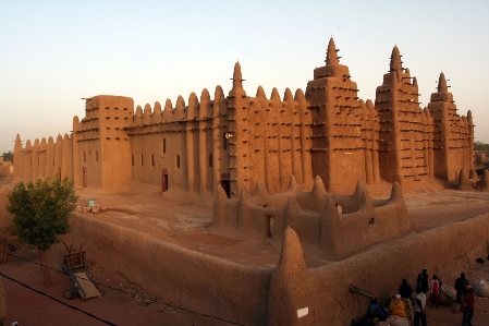
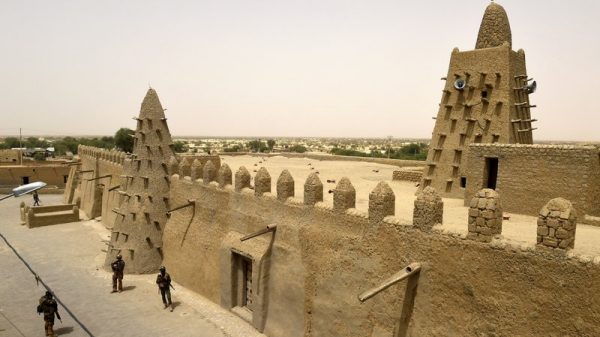
The city's golden age, during which it was a cultural center of learning and culture in Mali, is over, and has entered a long period of decline.
Read also:Tourism in Uganda and its most prominent tourist attractions
Various tribes ruled until the French took over in 1893, a situation that continued until it became part of the current Republic of Mali in 1960. Several prominent historical writers, such as Shabeni and Leo Africanus, described the city of Timbuktu, and these stories sparked speculation in Europe. The city's reputation has gone from being extremely rich to being obscure.
Archeology in Timbuktu
Similar to other important medieval West African cities, such as Djenné, Gao and Dia, Iron Age settlements have been discovered near Timbuktu, predating the traditional founding date of the city, although the accumulation of thick layers of sand has frustrated archaeological excavations in the town itself. Some of the surrounding landscape shrinks, revealing pottery shards on the surface. A study by Susan and Roderick MacIntosh in 1984 identified several Iron Age sites along the Red River, an ancient valley system that runs a few kilometers east of the city. modern.
The Iron Age complex, located 9 kilometers (6 miles) southeast of Timbuktu, near the Valley of the Reds, was excavated between 2008 and 2010 by archaeologists from Yale University and the Mission Culturelle de Tombouctou. The site was occupied in the fifth century BC, flourished during the second half of the millennium, and eventually collapsed in the late tenth or early eleventh century AD.
Read also:The most important tourist attractions in TunisiaWhere is Timbuktu located?
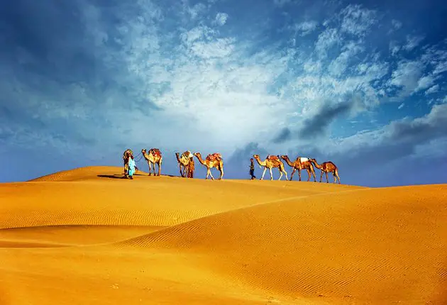
Timbuktu is located on the southern edge of the Sahara Desert, 15 km (9 mi) north of the main channel of the Niger River. The city is surrounded by sand dunes and the streets are covered with sand. The river has a 8-kilometre (5-mile) channel. The canal has become heavily polluted but in 3 it was dredged as part of a project funded by Libya.
The annual flooding of the Niger River is the result of heavy rains in the headwaters of the Niger and Bani rivers in Guinea and northern Ivory Coast. Precipitation in these areas peaks in August, but the floodwaters take some time to pass the river system through the inland Niger Delta, and in Koulikoro, 60 km away. Kilometers (37 mi) downstream from Bamako, the flood peaks in September, while in Timbuktu the flood lasts longer and usually reaches a maximum at the end of December.
In the past, the area flooded by the river was more extensive, with heavy rains, the flood waters reaching the western outskirts of Timbuktu itself, and a small navigable table to the west of the city is shown on maps published by Heinrich Barth in 1857, and Felix Dubois in 1896, Between 1917 and 1921, during the colonial period, the French used slave labor to dig a narrow canal connecting Timbuktu with Kabbara. Over the following decades, this became flooded and filled with sand, but in 2007 as part of a dredging project, the canal was re-dug so far when the river overflows Niger, Timbuktu is again linked to Kabbara.
Read also:Your complete guide to knowing the distances between South African cities
Timbuktu climate
Timbuktu has a hot desert climate according to the Köppen climate classification. It is hot and dry throughout most of the year. The average daily maximum temperatures in the hottest months of the year – April, May and June – exceed 40°C. The lowest temperatures occur during the winter in the hemisphere. Northern - December, January and February.


